Alicante Airport (ALC)
City Orientation and Maps
(Alicante, Spain)
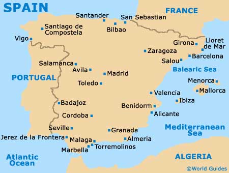
Alicante lies on the eastern coast of Spain, towards the south of the famous Costa Blanca. Located in the Comunidad Valenciana area, Alicante is easy to reach and surrounded by a number of fast roads, including the N-325, the N-330, the N-332 and the N-340.
To the east of Alicante, the Mediterranean Sea is the region's main attraction and is lined by glorious stretches of sandy coast. Alicante Airport (ALC) is located to the south-west of the city and can be found in nearby Elche, close to Crevillente. Other areas of interest within easy reach of Alicante include Busot, El Campello and San Vincente Del Raspeig to the north-east, Santa Pola and Guardamar del Segura to the south, and Aspe, Monforte Del Cid, Novelda and Rebolleco to the west.
Alicante Airport (ALC) Maps: Important City Districts
Alicante is divided into a number of main areas, with the Old Quarter being particularly prominent and full of historic attractions. Known locally as the Barrio de Santa Cruz or simply 'El Barrio', the Old Quarter is home to a range of shops, eateries, entertainment venues and the city's main bus and train stations, together with the cathedral and many lively night spots. Alicante's Old Quarter is edged by the Rambla de Méndez Núnez, a prominent thoroughfare which runs in a north / south direction.
Of course, many people fly into Alicante Airport for the glorious golden beaches, which are edged by typical beachfront attractions, including hotels, restaurants and cafes. Much of the coastline is lined by the Paseo Explanada Espana, which runs parallel to Alicante's harbour area.
Spain Map

Alicante Map


